
As UK maritime authorities urge operators to prepare for GPS disruption, what will this mean for UK sailors?.
Recent guidance from UK maritime authorities has highlighted an issue that was once considered 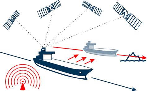
unlikely: sailors should be prepared to navigate during periods when GPS is unavailable, unreliable, or compromised.
For many recreational boaters, planning a trip now involves switching between multiple weather applications, tide tables, harbour guides, pilot books and local information sources.
When conditions change rapidly, finding and interpreting this information can become both time-consuming and challenging.
This changing landscape is driving interest in a new category of marine technology focused on maritime resilience rather than simple navigation.
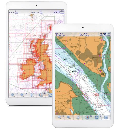
One emerging example is Scan and Go, a UK-developed platform designed to bring together weather forecasts, tides, harbour information, local knowledge and voyage planning resources within a single system.
Industry observers note that while GPS outages may be relatively infrequent, awareness of the risk has increased significantly. The issue is particularly relevant to coastal sailors, cruising yacht owners and small vessel operators who depend on multiple digital services when planning and undertaking voyages.
The move also reflects a wider trend within maritime technology, where resilience, redundancy and situational awareness are becoming increasingly important design principles.
As boating becomes more connected, sailors are beginning to ask not only what technology can do when everything works correctly, but how well it supports decision-making when systems fail.
For developers, marine businesses and boating organisations, the message is clear: the future of safer sailing may depend not on a single source of information, but on bringing together the right information at the right time.
In an era of growing GPS uncertainty, maritime resilience is becoming more than a technical issue. It is rapidly becoming a seamanship issue.
Editors note:
1. Maritime & Coastguard Agency (MCA)
Operating in GNSS Denied and Degraded Environments (MGN 719)
https://www.gov.uk/government/publications/mgn-719-mf-operating-in-gnss-denied-and-degraded-environments
Why it's relevant:
- Official MCA guidance to maritime operators.
- Warns about GPS/GNSS degradation, denial, jamming and spoofing.
- Encourages maritime stakeholders to maintain resilient navigation practices and contingency plans. [gov.uk], [gov.uk]
2. Maritime & Coastguard Agency (MCA)
Use of Electronic Navigational Aids (MGN 379 Amendment 1)
https://www.gov.uk/government/publications/mgn-379-mf-amendment-1-use-of-electronic-navigational-aids
Why it's relevant:
- Official guidance for navigators and watchkeepers.
- Specifically warns against over-reliance on a single electronic navigation aid.
- Recommends cross-checking positions using alternative methods. [gov.uk], [gov.uk]
3. Department for Science, Innovation and Technology (DSIT)
Positioning, Navigation and Timing (PNT) Overview
https://www.gov.uk/guidance/positioning-navigation-and-timing-overview
Why it's relevant:
- Explains the UK's dependence on GPS and other satellite navigation systems.
- Describes the Government's framework for greater PNT resilience.
- Notes the risks from GNSS interference and disruption. [gov.uk]
Further Reading
- MGN 719 (M+F) Operating in GNSS Denied and Degraded Environments (MCA): https://www.gov.uk/government/publications/mgn-719-mf-operating-in-gnss-denied-and-degraded-environments [gov.uk]
- MGN 379 (M+F) Amendment 1: Use of Electronic Navigational Aids (MCA): https://www.gov.uk/government/publications/mgn-379-mf-amendment-1-use-of-electronic-navigational-aids [gov.uk]
- Positioning, Navigation and Timing: Overview (DSIT): https://www.gov.uk/guidance/positioning-navigation-and-timing-overview [gov.uk]